Recent Research Projects
This site outlines recent research projects, which are primarily in the geospatial machine learning sphere. For blogs and open-source repositories, see:
Machine Learning Utility Manifolds
Studying performance curves along various axes yields far more insights than just a single datapoint denoting maximum performance. This concept has been an overarching theme for recent projects, summarized in:
Machine Learning Utility Manifolds for Novel Datasets.
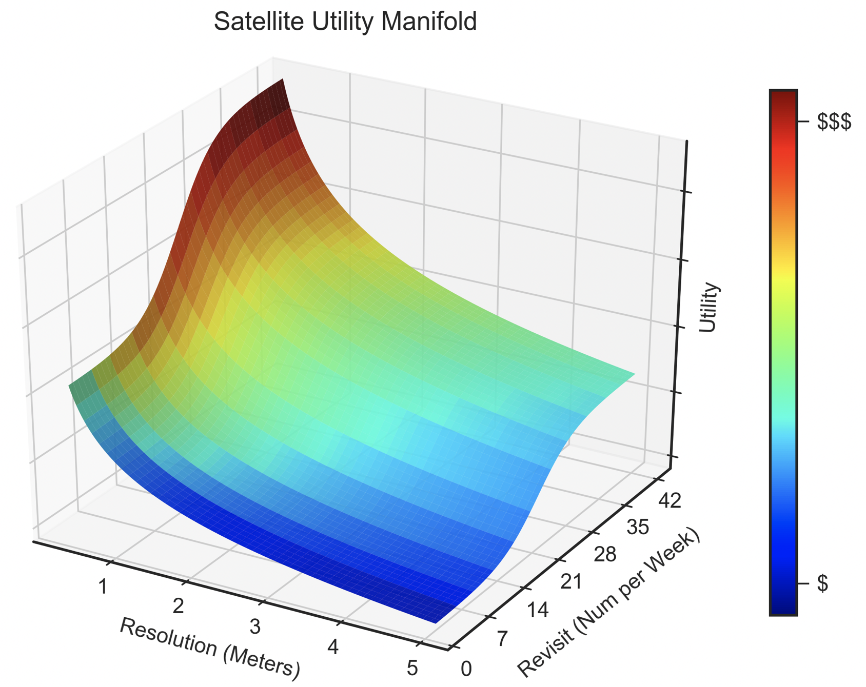
Notional utility manifold.
Medium Blog
Much of my research is available at medium.com/@avanetten, which has over 50 blogs on geospatial analysis.
Also check out the Training_Data podcast for multimedia, especially our Celebrating CosmiQ Works Podcast on YouTube.
Recent Academic Papers
The Weaknesses of Adversarial Camouflage in Overhead Imagery, Van Etten, A, 2022, arXiv
The Multi-Temporal Urban Development SpaceNet Dataset, Van Etten, A. et al., CVPR 2021
RarePlanes: Synthetic Data Takes Flight, Shermeyer, J., Hossler, T., Van Etten, A. et al., WACV 2021
SpaceNet 6: Multi-Sensor All Weather Mapping Dataset, Shermeyer, J. et al., CVPR EarthVision 2020
Road Network and Travel Time Extraction from Multiple Look Angles with SpaceNet Data, Van Etten, A. et al., IEEE International Geoscience and Remote Sensing Symposium (IGARSS 2020)
City-Scale Road Extraction from Satellite Imagery v2: Road Speeds and Travel Times Van Etten, A., WACV 2020
SpaceNet MVOI: A Multi-View Overhead Imagery Dataset, Nicholas Weir, David Lindenbaum, Alexei Bastidas, Adam Van Etten, Sean McPherson, Jacob Shermeyer, Varun Kumar, Hanlin Tang, Proceedings of the IEEE/CVF International Conference on Computer Vision (ICCV 2019)
The Effects of Super-Resolution on Object Detection Performance in Satellite Imagery, Shermeyer, J., Van Etten, A., CVPR EarthVision 2019
Satellite Imagery Multiscale Rapid Detection with Windowed Networks, Van Etten, A., WACV 2019
SpaceNet: A Remote Sensing Dataset and Challenge Series, Van Etten, A., D. Lindenbaum, T. Bacastow, 2018, arXiv
You Only Look Twice: Rapid Multi-Scale Object Detection In Satellite Imagery, Van Etten, A., 2018, arXiv
Selected Projects
Below is are a few recent projects. For a full list of projects, see github.com/avanetten or recent papers.
YOLT / SIMRDWN
Five years ago (2016) no open source codebase existed for applying state of the art obect detection methods towards the enourmous sizes and unique challenges of satellite imagery. Hence, YOLT was created atop the YOLO framework, and proved able to locate vehicles, ships, buildings, and airports with high precision.
Subsequently, SIMRDWN was created to extend the capabilities of YOLT to other object detection frameworks (YOLO, SSD, and Faster RCNN).
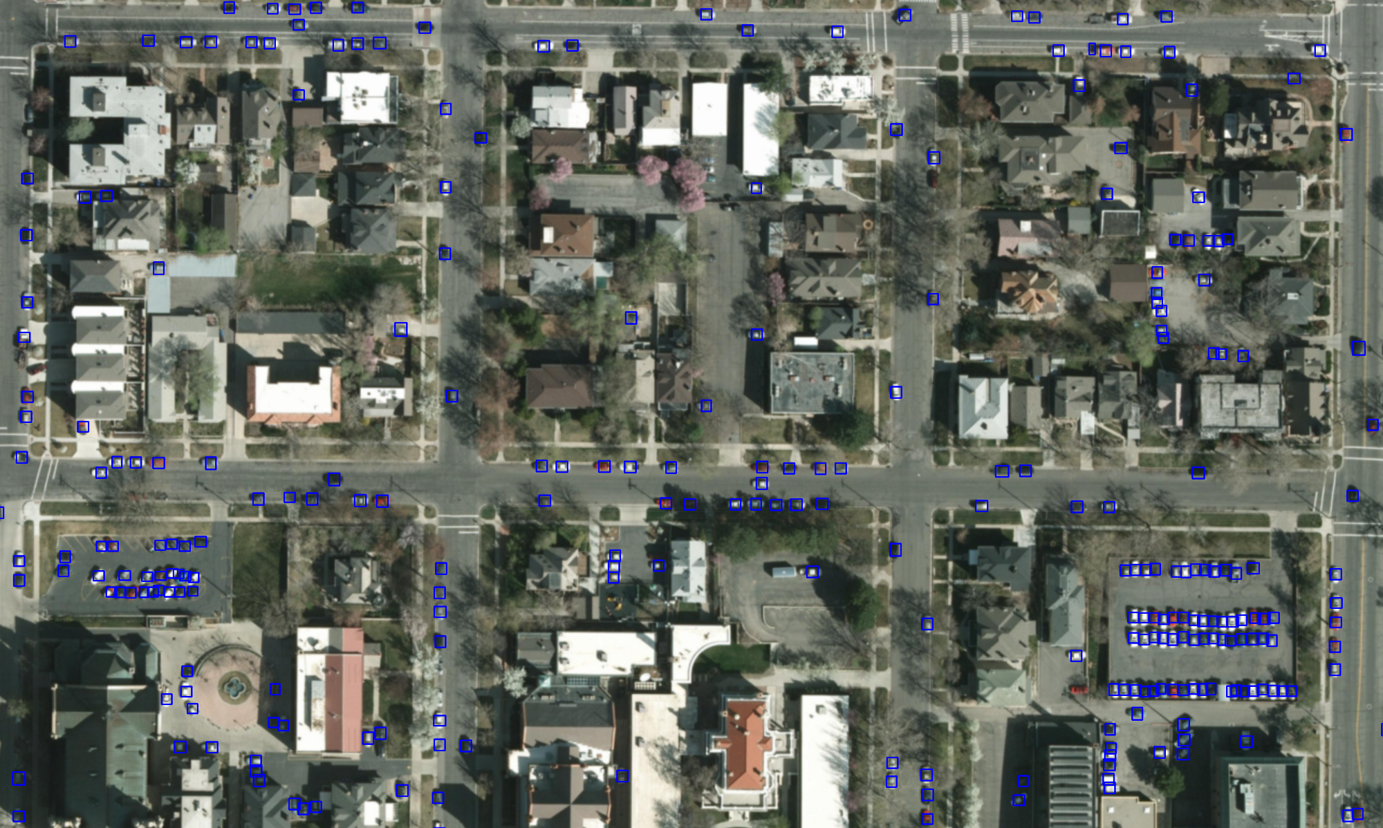
YOLT car predictions.
CRESI
The CRESI project provides an end-to-end pipeline to train models to detect routable road networks over entire cities, and also provide speed limits and travel time estimates for each roadway. We have observed success with both SpaceNet imagery and labels, as well as Google satellite imagery with OSM labels. CRESI served as the baseline model for SpaceNet 3 and SpaceNet 5 (see below).
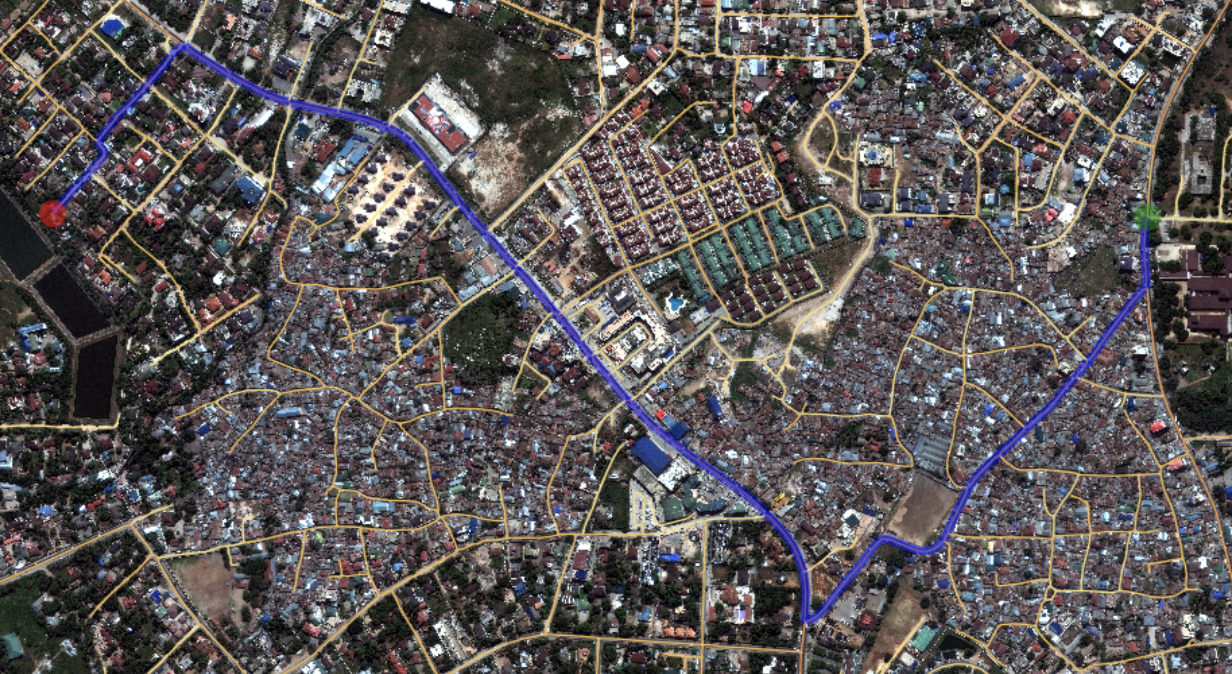
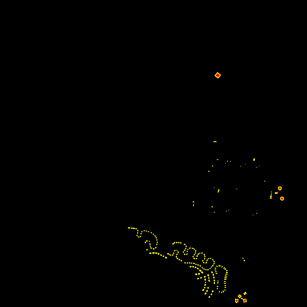
Sample extracted road network and computed optimal path.
APLS
In order to ascertain the quality of proposal graphs created by CRESI, a new graph-theoretic metric was required since existing metrics either ignored important graph features or could not be adapted to new use cases. APLS measures path lenth similarity for important segments, and was used to score both SpaceNets 3 and 5.
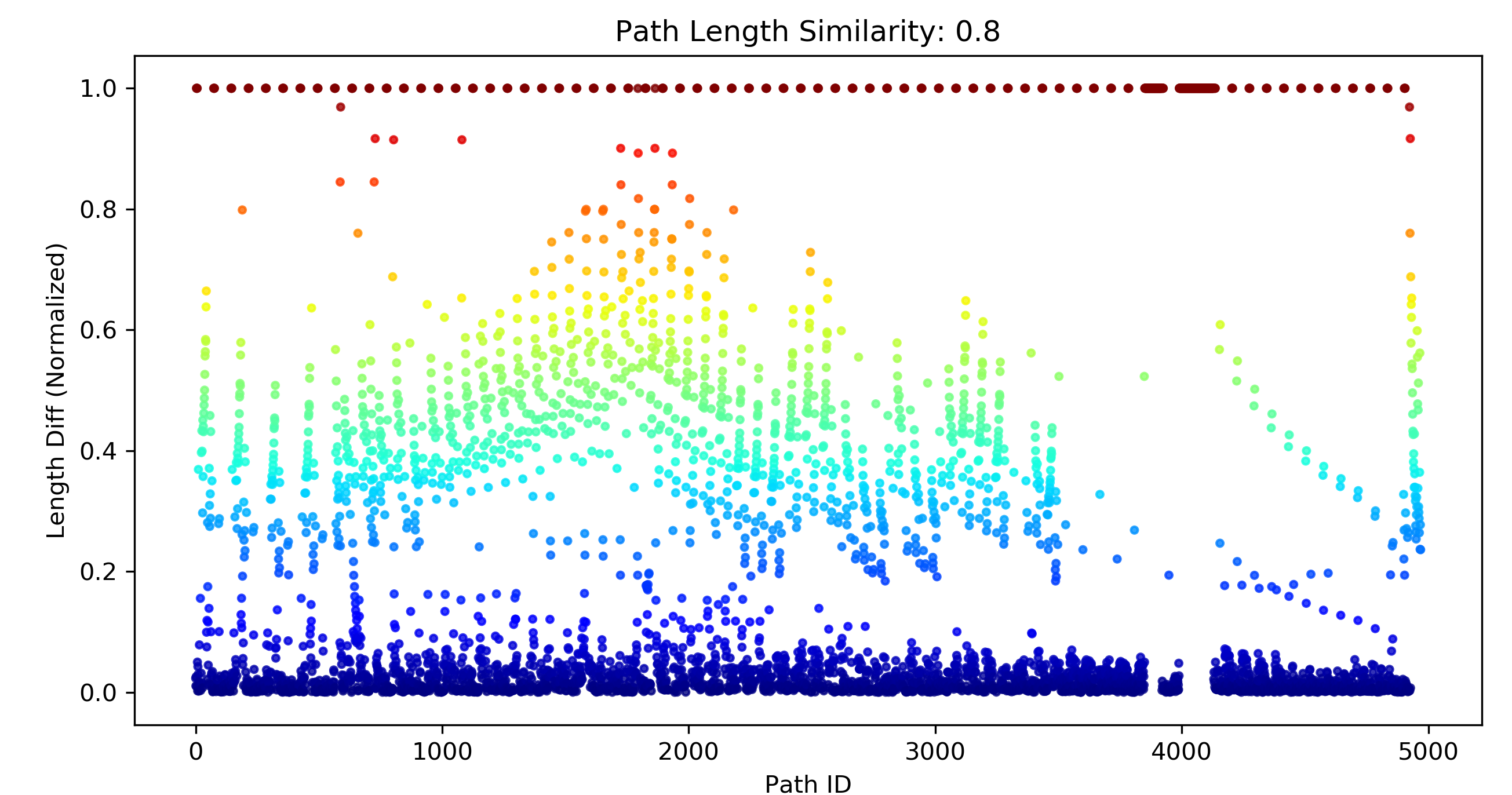
APLS path length differences.
SpaceNet
As a founding member of SpaceNet, I have been heavily involved in SpaceNets 1-7. SpaceNet is consortium dedicated to providing high quality labeled satellite imagery to the community, and running public data science challenges with these novel datasets. I served as Challenge Manager for SpaceNets 3, 5, and 7.
SpaceNet 3
SpaceNet 3 aimed to extract routable road networks directly from satellite imagery. To evaluate proposals, the APLS metric was created (see below). See the CosmiQ Works project page, SpaceNet page, or the papers above for further details about SpaceNet 3.
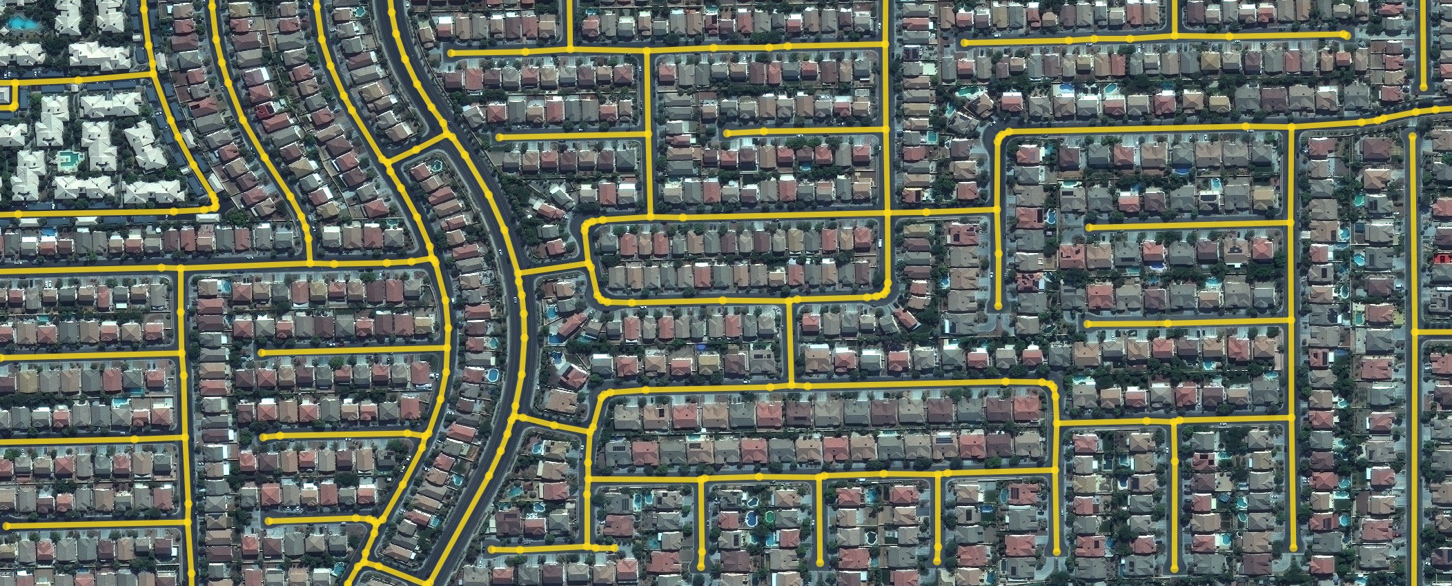
Predicted road network in Las Vegas.
SpaceNet 5
SpaceNet 5 built upon SpaceNet 3, and strove to infer travel times as well as physical geometry for road networks. aimed to extract routable road networks directly from satellite imagery. See the CosmiQ Works project page, SpaceNet page, or the papers above for further details about SpaceNet 5.
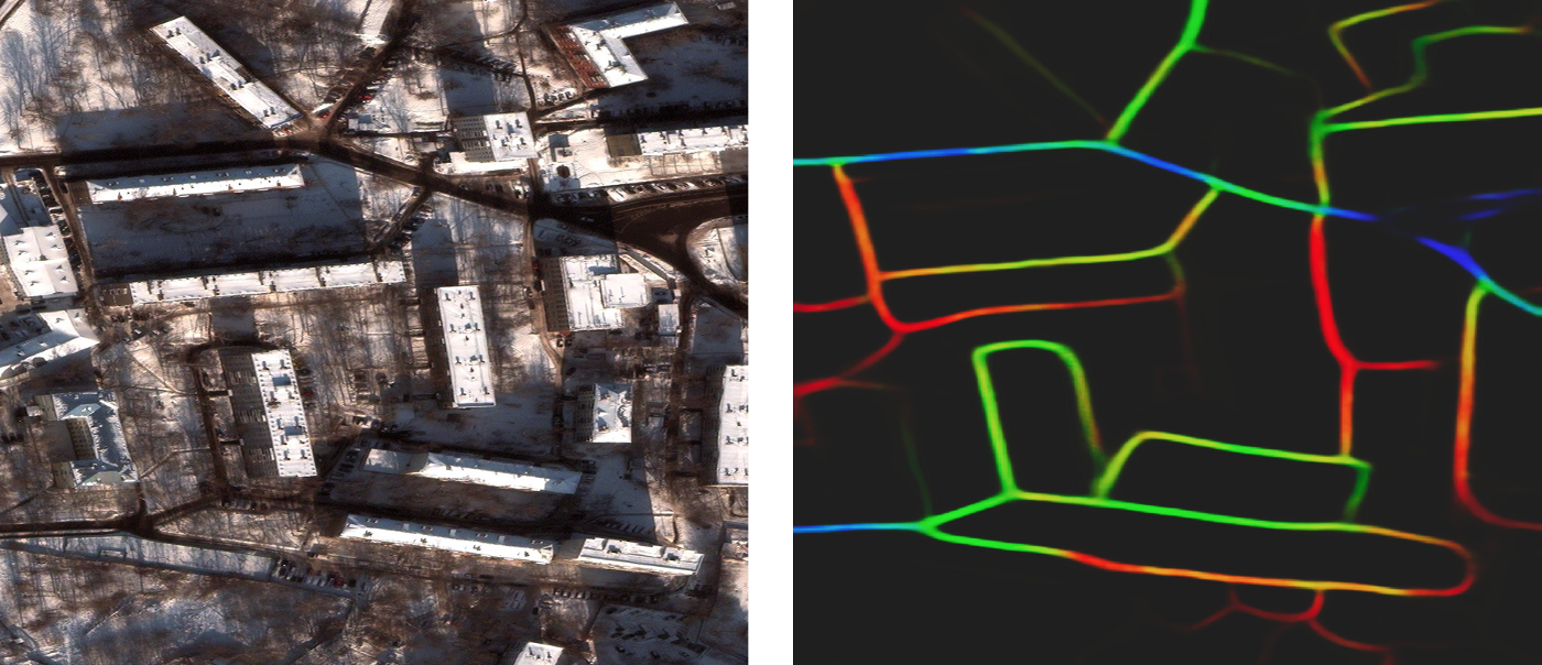
Road predictions, colored by speed.
SpaceNet 7
SpaceNet 7 was the first SpaceNet challenge to focus on time series analysis, specifically urban development and building tracking. See the CosmiQ Works project page, SpaceNet page, or the papers above for further details about SpaceNet 7.
Urban change captured in one of the SpaceNet 7 regions.